
From soundings to shared intelligence: ocean data as a strategic asset
A data shift below the waterline
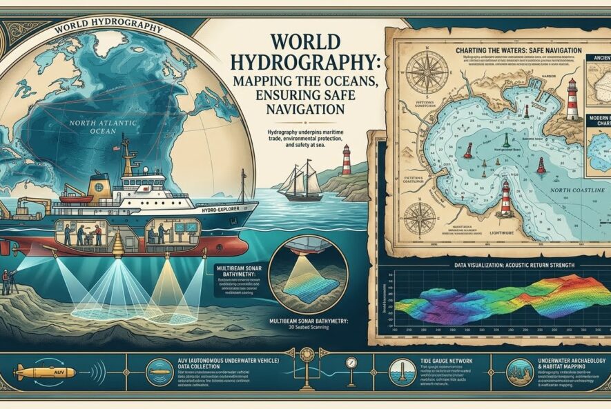
Every port call, subsea cable route, offshore wind lease, coastal resilience model, and maritime insurance decision depends on one basic question: what is actually under the water? Hydrography answers that question by measuring and describing the physical features of oceans, seas, coastal areas, lakes, and rivers, including how those features change over time [1]. On 21 June 2026, World Hydrography Day put a sharper point on that work: the official theme, “Transforming how ocean data is shared,” focused on the maritime sector’s move toward interoperable digital data through the S-100 framework [2].
For R&D leaders, this is not just a navigation story. It is a data governance story. The same bathymetry, water-level, current, seabed, and charting data that helps vessels move safely also feeds AI models, port digital twins, environmental monitoring, offshore asset planning, insurance analytics, and regulatory evidence packages.
The standard behind safer digital navigation
The International Hydrographic Organization developed S-100 as a Universal Hydrographic Data Model for future digital products and services [3]. Its importance lies in structure. Instead of treating charts as static products, S-100 supports product specifications such as S-101 Electronic Navigational Charts and S-102 Bathymetric Surface data, allowing different marine data layers to work inside a shared framework [2], [4].
| Decision area | Chart-centric workflow | S-100-style data workflow |
| Navigation | Static chart update cycles | Layered, interoperable digital services |
| R&D | Separate datasets and formats | Reusable data products for modelling |
| Regulation | Manual evidence compilation | Traceable data lineage and validation |
| IP strategy | Tool-by-tool analysis | Portfolio view across sensors, software, AI, and data processing |
A useful analogy is aviation: safe flight depends not only on the aircraft, but on shared airspace data, weather feeds, procedures, and certified systems. Maritime innovation is moving in the same direction. Better hydrographic data does not create value by sitting in a repository. It creates value when it is curated, validated, indexed, visualized, protected, and shared in a form that systems and people can use.
Discovery, curation, analytics, and AI
Hydrographic innovation starts with discovery: sonar, lidar, satellite-derived bathymetry, autonomous surface vessels, underwater vehicles, tide gauges, and coastal sensors. But discovery is only the first layer. Data curation determines whether measurements can be trusted later. Metadata, coordinate reference systems, uncertainty, survey date, sensor type, processing method, and quality flags all affect whether a dataset can support navigation, infrastructure design, environmental review, or litigation.
Data Management then turns survey outputs into controlled assets. Data Analytics extracts patterns: shoaling trends, channel change, sediment movement, dredging needs, current risks, habitat change, and traffic exposure. Artificial Intelligence can help classify seabed features, detect anomalies, merge sparse observations, and prioritize survey areas. Yet the contrarian insight is clear: AI does not remove the need for hydrographic standards. It increases it. Models trained on poorly described or unevenly governed marine data can produce confident but unsafe outputs.
Verified case module: mapping the unmapped seabed
The Nippon Foundation-GEBCO Seabed 2030 Project reported in April 2026 that 28.7% of the world’s ocean floor had been mapped, with almost five million square kilometres of data added over the prior year [5]. The figure is progress, but it also shows the remaining gap. More than two-thirds of the global seabed still lacked modern mapped coverage at that point.
This matters commercially. Offshore wind developers, cable planners, port authorities, coastal engineers, marine insurers, naval planners, and climate researchers all depend on seabed knowledge. The gap is not simply “more data needed.” It is better data sharing, better standards alignment, and better incentives for organizations to contribute usable information without compromising security, commercial confidentiality, or national interests.
Regulatory and IP strategy must move with the data
Digital hydrography changes the intellectual property question. The patentable invention is rarely “ocean data” by itself. More often, it sits in sensor configurations, calibration methods, automated quality control, data fusion, compression, route-risk scoring, AI classification, visualization, autonomous survey planning, or decision-support software.
That makes prior art search more demanding. Teams should review patent literature, scientific publications, standards documents, hydrographic product specifications, open-source repositories, procurement records, and public testbeds. Freedom-to-operate analysis should cover software modules, data pipelines, third-party models, licensing terms, charting standards, interface dependencies, and claims around autonomous or AI-assisted survey systems.
Patent drafting and filing should be specific about the technical contribution: the input data, processing sequence, validation method, uncertainty handling, system architecture, and measurable performance improvement. For Technology Transfer teams, the strongest commercialization pathway may combine patents, trade secrets, data rights, know-how, regulatory evidence, and standards participation. IP protection strategy should therefore be built before pilots, not after public demonstrations.
India and the regional data opportunity
India’s maritime position gives hydrography direct strategic relevance. The Press Information Bureau reported in 2024 that the Indian Naval Hydrographic Department functions under the Indian Navy as the nodal agency for hydrographic surveys and nautical charting in India, with more than 650 electronic and paper navigation charts published for merchant mariners and navies [6]. The National Hydrographic Office also lists a Naval Chart Depot at Visakhapatnam [7].
For Indian R&D institutions, ports, coastal agencies, and marine technology companies, the opportunity is practical: align survey data, analytics, IP review, and commercialization planning from the start. That can reduce duplication, improve regulatory readiness, and make marine innovation easier to scale.
Where Saturo Global supports the workflow
Saturo Global supports research, data, and IP teams working at the intersection of science, technology, and commercialization. Our services connect Data Curation & Management, Indexing & Abstracting, Strategic Patent Support, PatBase, Origin, Chemical Explorer, and Data Visualization into structured workflows for evidence-led decision making.
For hydrography and marine technology teams, that support can include prior art search, freedom-to-operate support, patent landscape support, patent drafting and filing support, and IP protection strategy. The goal is to help teams move from scattered survey outputs and technical documents to searchable intelligence, defensible innovation positions, and clearer commercialization choices.
Schedule a demo for a walkthrough of Minesoft PatBase and Origin.
References
[1] International Hydrographic Organization. 2022. Importance of Hydrography. IHO. Link. (IHO)
[2] International Hydrographic Organization. 2026. World Hydrography Day. IHO. Link. (IHO)
[3] International Hydrographic Organization. 2022. S-100 Universal Hydrographic Data Model. IHO. Link. (IHO)
[4] International Hydrographic Organization. 2026. The S-100 framework is now operational. IHO. Link. (IHO)
[5] International Hydrographic Organization. 2026. Global seabed mapping reaches new milestone as five million square kilometres added in a year. IHO. Link. (IHO)
[6] Press Information Bureau, Ministry of Defence, Government of India. 2024. World Hydrography Day 2024. PIB. Link. (Press Information Bureau)
[7] National Hydrographic Office, India. 2026. Contact Naval Chart Depots. NHO. Link. (NHO)