Land restoration needs a data-to-IP operating system
Why land risk belongs on the R&D agenda
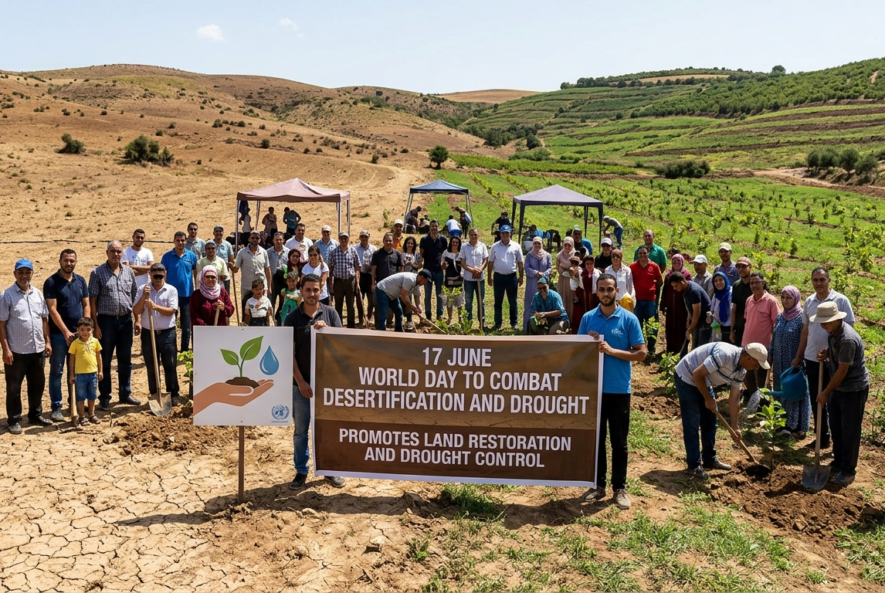
On 17 June, Desertification and Drought Day brings a useful test for research and innovation teams: can land restoration move from awareness campaign to investable workflow? The UN General Assembly declared 17 June as the World Day to Combat Desertification and Drought in 1994, with observance beginning in 1995 [1]. For 2026, Kenya is hosting the global observance under the theme “Rangelands: Recognize. Respect. Restore.” [2]
The business case is no longer abstract. UNCCD reports that up to 40% of the world’s land is degraded, affecting more than 3 billion people [4]. IPBES estimates that land degradation affects 3.2 billion people and causes economic losses in the order of 10% of annual global gross product [5]. For R&D leaders, this is a portfolio issue: soil, water, biodiversity, drought resilience, data infrastructure, AI, patentability, regulatory planning, and commercialization are now linked.
The investable unit is not land. It is verified evidence.
Rangelands cover more than half of Earth’s land surface and support the lives of two billion people, including 500 million pastoralists [2]. That scale creates a data problem before it creates a technology problem. A restoration claim must be tied to baseline condition, intervention, monitoring method, social context, and repeatable measurement.
A good analogy is a clinical trial. No serious investor accepts “the patient looks healthier” as evidence. They ask for baseline, protocol, endpoints, controls, and follow-up. Land restoration needs the same discipline.
| Decision point | Evidence needed | IP and commercialization implication |
| Discovery | Soil, water, crop, climate, biodiversity, and land-use data | Defines technical problem and invention boundaries |
| Data curation | Cleaned, indexed, traceable datasets | Reduces weak analytics and supports defensible claims |
| Data analytics and AI | Change detection, drought-risk models, productivity analysis | Creates protectable software, models, workflows, and know-how |
| Technology transfer | Licensing, pilots, field validation, local adoption | Requires ownership clarity and FTO review |
| Filing strategy | Prior art, patentability, claim scope, jurisdiction | Protects inventions without blocking deployment |
The contrarian insight is that AI is not the main bottleneck. Data management is. IPCC states that sustainable land management is advanced by involving stakeholders in identifying land-use pressures and impacts, and by preventing, reducing, and restoring degraded land [6]. In practice, AI trained on poor field data, weak labels, or inconsistent satellite interpretation can scale error faster than insight.
Where digital tools can reduce uncertainty
FAO’s WaPOR platform shows the kind of infrastructure needed. It is a publicly accessible near-real-time database using satellite data to monitor agricultural water productivity at different scales, and in its second phase works with 13 partner countries on local water and land productivity challenges [7]. This is not a substitute for field work. It is a way to connect remote sensing, local validation, and decision support.
UNCCD’s Drought Toolbox also points to the required structure. It supports National Drought Policy Plan design and organizes resources around monitoring and early warning, vulnerability and risk assessment, and risk mitigation [8]. Those modules map directly to R&D workflows: discovery, risk scoring, solution design, and deployment planning.
Verified case module: WaPOR and water productivity
WaPOR is useful because it turns satellite observation into operational data for agriculture and water management. FAO describes it as a near-real-time database for monitoring agricultural water productivity at different scales [7]. By May 2026, FAO reported WaPOR-related work in Iraq, Balochistan, Mozambique, Palestine, and Kenya, including irrigation monitoring, crop mapping, and yield analysis [7].
For commercialization teams, the case is not “satellites solve drought.” The real lesson is narrower and stronger: a validated data layer can shorten the distance between research, policy decisions, field deployment, and IP review.
How IP teams should read the opportunity
Land restoration technologies rarely sit in one patent bucket. They may involve sensors, bio-inputs, irrigation control, soil amendments, remote sensing, decision-support software, carbon measurement, water treatment, seed systems, grazing tools, or data visualization. WIPO notes that climate action depends partly on green technology diffusion and that WIPO GREEN connects technology providers with seekers through a marketplace and database [9]. The EPO’s Y02/Y04S tagging scheme also helps retrieve patent documents related to climate change mitigation technologies [10].
That matters for three reasons. First, prior art search should include patent and non-patent sources: journal articles, government toolkits, satellite-data methods, open-source models, and traditional land-management practices. Second, freedom-to-operate analysis should be done before pilots, not after field adoption. Third, patent drafting and filing should separate what is truly inventive from what is public, traditional, regulatory, or obvious.
A stronger IP protection strategy may combine patents, trade secrets, data rights, copyright in software, database governance, trademarks for tools, and licensing terms for technology transfer. Regulatory strategy also needs early attention where claims involve carbon storage, biodiversity benefit, water productivity, drought-risk prediction, or farm advisory outputs.
Saturo Global’s role in the workflow
Saturo Global supports research, data, and IP teams that need to turn complex environmental and technical information into usable intelligence. Our work spans Data Curation & Management, Indexing & Abstracting, Strategic Patent Support, PatBase, Origin, Chemical Explorer, and Data Visualization.
For land restoration, drought resilience, and sustainable agriculture portfolios, Saturo Global can support prior art search, freedom-to-operate support, patent landscape support, patent drafting and filing support, and IP protection strategy. The value is in connecting curated scientific evidence, patent intelligence, and commercial decision-making before teams commit capital, launch pilots, or make public claims.
Schedule a demo for a walkthrough of Minesoft PatBase and Origin.
References
[1] United Nations General Assembly. 1994. Observance of World Day to Combat Desertification and Drought: Resolution A/RES/49/115. UN Digital Library. Link: (United Nations Digital Library System)
[2] United Nations Convention to Combat Desertification. 2025. Rangelands to Take Centre Stage on Desertification and Drought Day 2026 in Kenya. UNCCD. Link:
[3] United Nations Convention to Combat Desertification. 2026. Rangelands and pastoralists. UNCCD. Link: (UNCCD)
[4] United Nations Convention to Combat Desertification. 2025. Desertification and Drought Day 17 June 2025 Factsheet. UNCCD. Link: (UNCCD)
[5] Intergovernmental Science-Policy Platform on Biodiversity and Ecosystem Services. 2018. The Assessment Report on Land Degradation and Restoration: Summary for Policymakers. IPBES. Link:
[6] Intergovernmental Panel on Climate Change. 2019. Climate Change and Land: Summary for Policymakers. IPCC. Link: (IPCC)
[7] Food and Agriculture Organization of the United Nations. 2026. WaPOR, remote sensing for water productivity. FAO. Link: (FAOHome)
[8] United Nations Convention to Combat Desertification. 2026. Drought Toolbox. UNCCD. Link: (UNCCD)
[9] World Intellectual Property Organization. 2020. WIPO GREEN: supporting green innovation and technology transfer. WIPO Magazine. Link: (WIPO)
[10] European Patent Office. 2019. Climate change mitigation technologies. EPO. Link: (EPO)